
Just a Word about Free Cartography and OpenStreeMap...
Do you know OpenStreeMap? it's an alternative to Google Map that is developed collaboratively. Do you know what it means (for a map)? it means that it grows thanks to its user community, instead of a private (or public) company. It also looks the way the community wants. The first link was the "default" aspect, OpenCycleMap provides an alternative one, oriented towards biking, OpenSeaMap for sailing, hiking maps, etc.
Rendering a map is not an easy task, however populating it is. Indeed, OpenStreetMap is more a database than a drawing (that's why the 'default' rendering is not best). And adding information to the database is easy. Open [OpenStreetMaphttp://www.openstreetmap.org/], go to a place you like and know (very) well, and add what is missing. In rural areas, that can be a road or an entire village, that will be harder!
And the good thing about communities, it's that they're as reactive as they're interested in the project. Take that screenshot for instance:
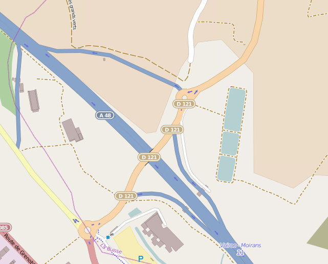
you see the highway entry in the upper part ? it opened one month ago. See the roundabout? it was build ... maybe half a year ago. Now compare with Google Map:
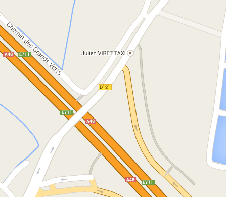
None of them! What about the (French) National Mapping Institute:
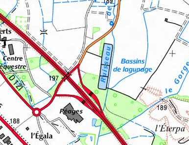
Nope, not better, maybe even worst!
One last thing, the Open Source Routing Machine project adds route computation to OpenStreeMap, [very very useful, quick and efficient|http://map.project-osrm.org/?loc=grenoble&loc=giens| !
Geoportail is the official portal for online IGN maps. They provide great hiking maps, the best you can find for France ... but I feel the default interface tedious to use, slow, un-intuitive, not fullscreen, (based on Flash). But there is an alternative !, and they provide it themselves! It's the mobile version. Just agree that you want to use this version on your computer, switch to Maps (Cartes), and there you are!
And an example of a region I mapped, where my parents live:
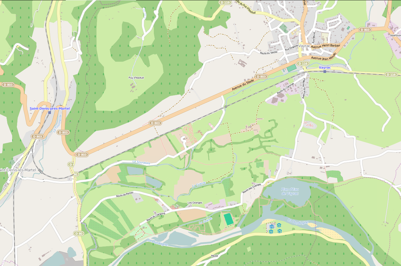
You can see clearly on the West side, at the junction of the railway and D80, where I stopped mapping! On the South, the limit is the river, and Est, it's more or less the Route des Granges road.
Rendering a map is not an easy task, however populating it is. Indeed, OpenStreetMap is more a database than a drawing (that's why the 'default' rendering is not best). And adding information to the database is easy. Open [OpenStreetMaphttp://www.openstreetmap.org/], go to a place you like and know (very) well, and add what is missing. In rural areas, that can be a road or an entire village, that will be harder!
And the good thing about communities, it's that they're as reactive as they're interested in the project. Take that screenshot for instance:
you see the highway entry in the upper part ? it opened one month ago. See the roundabout? it was build ... maybe half a year ago. Now compare with Google Map:
None of them! What about the (French) National Mapping Institute:
Nope, not better, maybe even worst!
One last thing, the Open Source Routing Machine project adds route computation to OpenStreeMap, [very very useful, quick and efficient|http://map.project-osrm.org/?loc=grenoble&loc=giens| !
Geoportail is the official portal for online IGN maps. They provide great hiking maps, the best you can find for France ... but I feel the default interface tedious to use, slow, un-intuitive, not fullscreen, (based on Flash). But there is an alternative !, and they provide it themselves! It's the mobile version. Just agree that you want to use this version on your computer, switch to Maps (Cartes), and there you are!
And an example of a region I mapped, where my parents live:
You can see clearly on the West side, at the junction of the railway and D80, where I stopped mapping! On the South, the limit is the river, and Est, it's more or less the Route des Granges road.
